
SIA-India Pre-Budget Submission Urges Satellite Backbone to Empower 40,000 Connectivity-Fragile Gram Panchayats
SIA-India has called for the launch of a National Satellite Connectivity Mission (NSCM) to ensure uninterrupted digital governance and public service continuity in ~40,000 Gram Panchayats where terrestrial links repeatedly fail due to topographical challenges, multi-week outage cycles, and chronic disaster exposure. These are not lagging-rollout zones but permanently connectivity-fragile geographies across the Himalayas, North-East hilly belts, Nicobar island chain, LWE corridors, desert interiors and cyclone-recurrence coastlines.
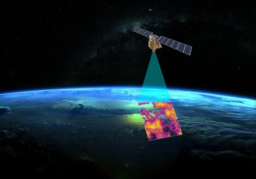
SIA-India states that satellite backhaul at Gram Panchayat is critical for enabling terrestrial Wi-Fi/4G networks to function continuously in geographies where fibre routes fail structurally. Satellite is not a fallback, it is the only resilient mode, and the budgetary ask is not simply a universal subsidy; it is a hard-geography mandate.
India’s official connectivity ledger also reinforces the continuity need beyond episodic outages. BharatNet records as of June 2025 show that out of 6,55,968 total villages, only 2,02,107 have been covered, leaving 4,53,861 still outside functional reach, and although 1,04,574 Wi-Fi hotspots have been installed, only 766 remain active.
As per the records, only 5,034 Gram Panchayats are currently connected via satellite, representing barely one-tenth of the continuity-vulnerable footprint, which more accurately spans ~40,000 connectivity fragile Gram Panchayats. Further, given the profile of these regions, satellite remains the only feasible continuity mechanism; the ~40,000 GP cluster cited is rather a conservative baseline, with upward revision anticipated.
The association urges that this is not a technology-preference debate but a structural reality in which satellite and fibre must function as equal continuity pillars—together forming a resilient policy-achievable layer.
Recently, we have seen continuity breakdowns across India’s most fragile geographies shift from exceptional events to predictable patterns. In Great Nicobar, the September 2025 submarine-cable break triggered a complete communication blackout for several days, cutting off residents, health units, security posts and civil administration until emergency VSAT deployment restored minimal connectivity—BSNL enabling partial messaging and Airtel air-lifting a V-SAT terminal to Campbell Bay to activate basic 2G service.
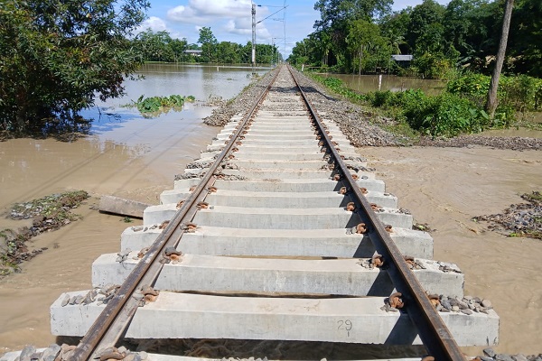
In Himachal Pradesh, the August 2025 landslide cycle left 1,155 of 1,761 telecom sites non-functional in Chamba, with restoration plateauing at 65% despite continuous field deployment—demonstrating that in elevation belts, cyclone corridors, island chains and forest interiors, terrestrial recovery is measured in weeks, not hours, and that these zones are no longer temporary dark-spots but enduring non-terrestrial continuity regions.
Similar structural fragility persists across the North-East, where 3,841 villages remain outside mobile coverage, including 1,735 in Arunachal Pradesh alone.
SIA-India therefore, positions satellite capacity not as an alternative nor a competitor, but as a co-equal sovereign communication layer to ensure uninterrupted access to DPI rails (Aadhaar, UPI, DigiLocker), telemedicine grids, school networks, maritime/border command links and NDMA warning channels.
“Satellite and terrestrial networks serve India best when deployed as parallel continuity pillars, each operating where the terrain allows them to succeed,” said Anil Prakash, Director General, SIA-India.
“The National Satellite Connectivity Mission simply recognises that nearly 40,000 Gram Panchayats fall in permanent hard-geography zones where restoration cycles run into weeks, and physical rebuilds repeatedly fail. This is not a universal subsidy proposition, but a geography-defined continuity mandate. A dedicated USOF window with VGF support aligns with the Ministry of Finance’s own treatment of digital access as core social infrastructure—no different in governance necessity from health, education and water systems”
The proposed NSCM aligns with BharatNet Phase-III, NDMA’s multi-hazard modernisation, island command infrastructure, Digital India backbone continuity and Vision India@2047’s principle that last-mile access cannot be contingent on road access, ridge stability or monsoon survivability.
Global public-sector models have all converged on one principle: where terrain, climate and distance make fibre unrecoverable within governance timelines, satellite is formalised as the continuity backbone. The United States (BEAD, RDOF) classifies satellite as a mandated layer for permanently hard-to-reach districts; Australia (Sky Muster, STAND) routes disaster corridors and island chains through satellite backhaul; and Europe (Secure Connectivity, GOVSATCOM) embeds sovereign satellite nodes to preserve command, civil protection and public-service access during terrestrial failure. These frameworks recognise satellite as not an alternative technology, but the only viable continuity architecture for state services and emergency communication.
Above views are of the author and not of the website kindly read disclaimer