
Digital crop survey in 19 Uttar Pradesh districts.
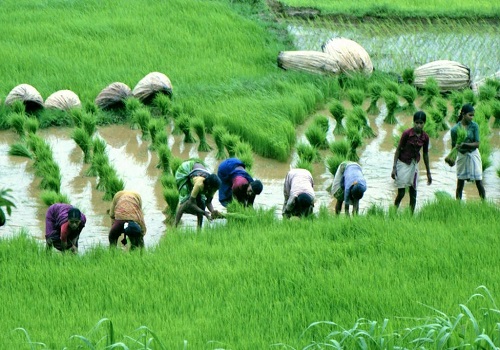
The Uttar Pradesh government has shortlisted as many as 19 districts for an ambitious satellite-linked digital crop survey project, to determine the crop-sown data on a real time basis in the forthcoming Kharif season.
The districts which have been selected for the project are Varanasi, Ayodhya, Chandauli, Bhadohi, Sant Kabir Nagar, Auraiyya, Mahoba, Hamirpur, Chitrakoot, Jhansi, Jalaun, Sultanpur, Jaunpur, Pratapgarh, Mirzapur, Moradabad, Farrukhabad, Basti and Hardoi.
The project is also proposed to be executed in at least 10 villages of different tehsils in the rest 56 districts on a pilot basis.
The government would be geo-referencing the agricultural land before the 2023-24 Kharif and Rabi cropping season, officials said.
The state government aims to cover the entire state by 2024-25.
The development comes less than a month after the Centre signed an agreement with six states, including Uttar Pradesh, Assam, Madhya Pradesh, Odisha and Rajasthan, to begin the digital crop survey.
The survey is essentially part of the government's 'Agristack' of the India Digital Ecosystem and Agriculture (IDEA) that has been under development since 2020.
Officials said that the survey will establish a clear picture of crops being sown across all the farmlands in the country during the different agriculture seasons.
The project aims to create one verified source of truth about the farmer and his/her crop sown data.
"A robust, effective, on-time, transparent digitally driven crop survey system that uses the latest technological advancements such as visual and advanced analytics, GIS-GPS technologies," said a senior official.
Additional Chief Secretary (agriculture) Devesh Chaturvedi said that the project would primarily help the state farmers by providing them various benefits, including those linked to government schemes, crop loan, insurance and better compensation as per the minimum support price.
He said that the technique will also enable the farmers to get the advice to boost crop cultivation and achieve the set target.
Officials said that the project is also aimed to determine the actual state domestic product and assess the impact of the drought or the drought-like-situation on the crop productivity.
As a matter of fact, the state revenue department is in the process of getting village maps digitalised and geo-referenced.
Officials said that the data based on high resolution satellite images of gram panchayats in at least 23 districts has been prepared by the National Remote Sensing Centre.